5.3 hr
Overview
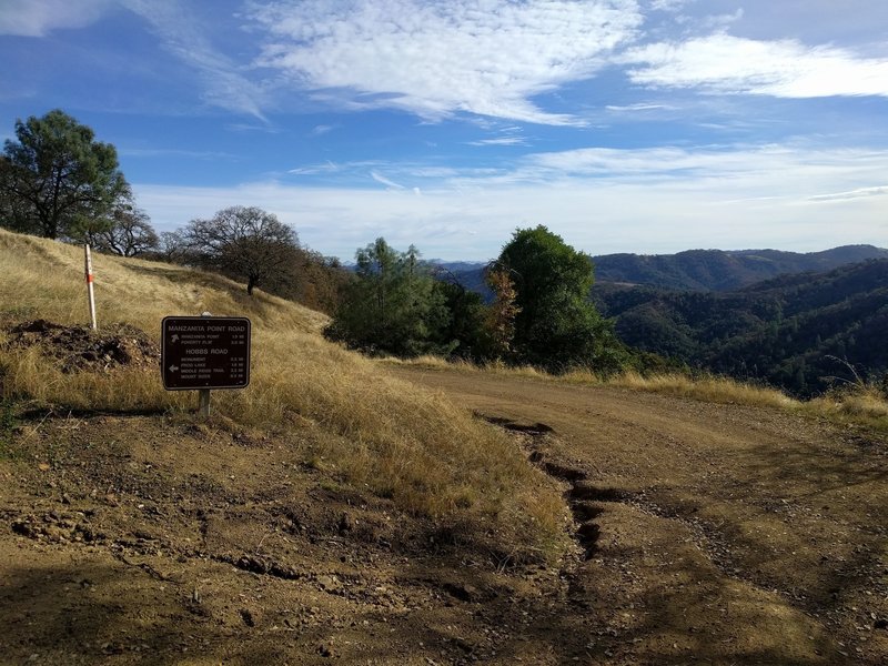
Start at the Coe Ranch Headquarters parking lot at the end of Dunne Avenue. The drive up is windy and narrow, with some great scenery.<br><br>Take the road to Manzanita Point, which is on your left as you enter the Ranch, across from the first parking area. The road quickly hits a gate, turning to dirt on the other side. <br><br>In about a mile, pass the intersection with Hobbs Road, staying right. In another .2 miles you'll reach the intersection with Flat Frog (well marked) on the left. Flat Frog is a pleasant, moderate singletrack, which serves as a good warm up for Middle Ridge. The marked "obstacles" are minor and a sandbag, given the unmarked, far more severe terrain to come.<br><br>After about 2.5 miles, Flat Frog dumps you near the top of Hobbs Road. Head right, across a small stream, then climb Hobbs for about 2 miles to pick up Middle Ridge. <br><br>Middle Ridge will be on your right. It is nearly 4 miles of rolling, smooth, exposed, and at times steep singletrack. There are few obstacles, some erosion, and wonderful scenery. The steep sections descend a multitude of switchbacks, cliff sides, and dry trail, making some sections walk-a-bike for less experienced riders. It is still doable and can be pleasant, but use good judgment. <br><br>Middle Ridge crosses the Coyote Creek just before joining Poverty Flat Road. Turn right, and this fire road is an imposing grade for about 2 miles of the 3.3 mile return to the parking lot. It is a fitness test and grueling at that. Poverty will take you back to Manzanita Road, past the Flat Frog junction, past the Hobbs Road junction, and back to the parking lot.<br><br>As an alternative, you can reduce the grade and add some mileage by heading left on Poverty for a short ways to Cougar Trail. Take this to the right, then hang right when it meets China Hole. China Hole lets out at the bottom of Manzanita Road. Take Manzanita to the right and it will return you to the parking lot. This adds about 2 miles and requires more daylight as it is singletrack in the woods - t
Trail Stats
16.7 km
678 m
869 m
376 m
—
Photos
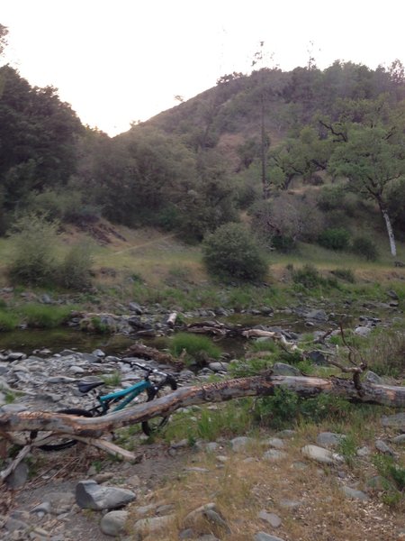
Crossing Coyote Creek and looking back on the descent.
Crossing Coyote Creek and looking back on the descent.
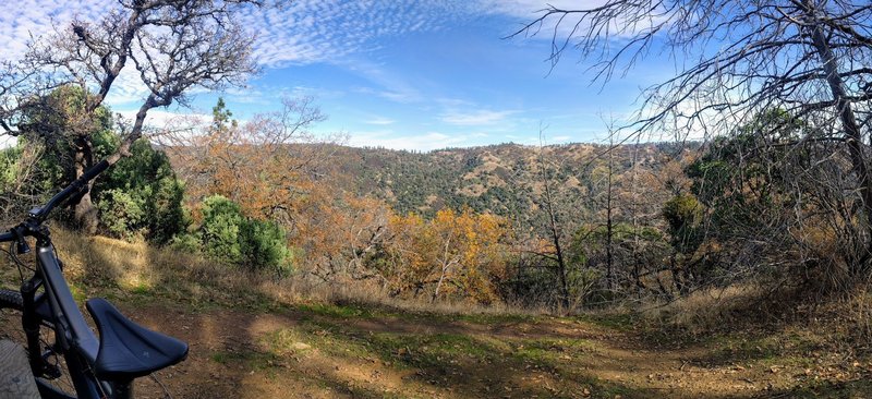
A lookout point with a nice picnic bench.
A lookout point with a nice picnic bench.
Tall grass and manzanita trees abound.
Tall grass and manzanita trees abound.
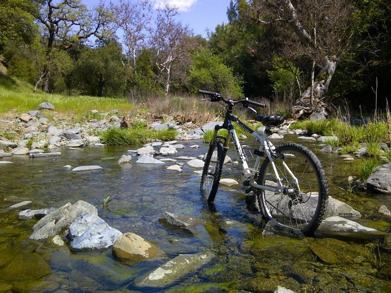
Creek crossing at Henry W. Coe State Park
Creek crossing at Henry W. Coe State Park
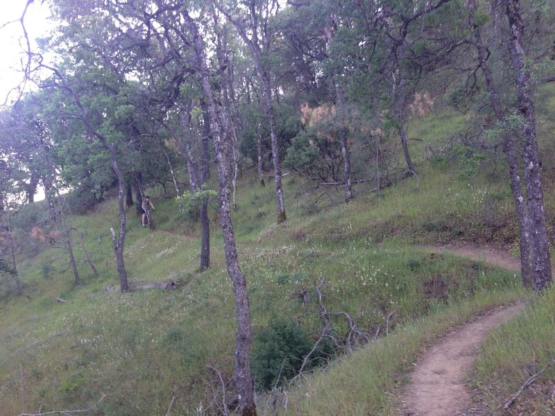
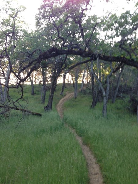
Winding through the Flat Frog woods
Winding through the Flat Frog woods
This will be one of the first forks you reach, and it is a bit confusing, I went up towards middle ridge, and you should go right towards frog trail.
This will be one of the first forks you reach, and it is a bit confusing, I went up towards middle ridge, and you should go right towards frog trail.