0 min
Overview
"This ride is intermediate ñ expert technical and expert aerobic. Get a map from the main visitor center and study it before attempting this route. This is a wild place with a lot of trails. The best time to ride this trail is spring or fall. I prefer the spring because the falls will have more flow. Summer would be almost impossible to carry enough water to safely complete this route. The trail is 25+ miles with many options. The route I supply is my favorite enjoy at your own risk. From the Hunting Hollow entrance warm your legs up with the short climb to the Coyote Creek entrance on the right hand side of the road. Cross the gate and climb 1 mile up Coit Road to the Anza trail on the right hand side. Get ready for your first climb of the day. Climb the sweet single track of Anza for .9 mile till you reach the Jackson Trail. Continue climbing on the Jackson trail single track for 1.4 miles it then becomes a double track continue on that double track for another 1.6 miles until you reach the Kelly Lake Trail on the left hand side. Head down the steep Kelly Lake trail for 1 mile until it deposits you, at you guessed it Kelly Lake. Take a break and eat something you deserve it. From Kelly Lake you want to turn left at the junction and head northwest towards Coit Road about .1 miles and there you will spot an outhouse. Turn right on Coit Road and head east for 1.1 miles until you reach Coit Lake. Take the .2 mile spur for a look at Coit Lake and then return back to Coit road and continue east towards Wagon Road for .7 miles. From the T at wagon Road Turn Right (South) for .2 mile and do a 180 degree turn onto Live Oak Spring Trail. Follow Live Oak Spring(stay right at the fork) for 1.1 miles then turn right at the Y and head on down to Lower Pacheco Falls about 1 mile. From lower Pacheco Falls head back up the trail toward Wagon Road after about 200 or 300 yards park your bikes and follow a short spur on the right of the trail to a great view of the upper Pacheco Falls (see pictures). After visiting the fa
Trail Stats
0.0 km
0 m
0 m
0 m
—
Photos
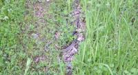
Pachecho Falls
Pachecho Falls